Fundamentals of Spatial Data Acquisition and Mapping

Content
Syllabus
Introduction to Spatial Data and Mapping (1 hour lecture)
- Definitions of terms (maps, mapping, geography, geodata, spatial data)
- Overview of mapping and its applications
History of Mapping (3 hours lecture)
- Early maps and cartography
- Key developments in the history of mapping
Types of Maps (3 hours lecture)
- Physical, political, thematic maps, topographic maps
Map Elements (3 hours lecture, 1 hour exercises)
- Labels, annotations, symbols and their meanings, legends and scale bars
Map Projections and Coordinate Systems (2 hours lecture, 2 hour exercises)
- Types of map projections
- Distortions and their implications
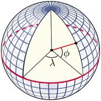
- Geographic vs. cartesian coordinate systems
Spatial Data Acquisition Methods (2 hours lecture, 2 hour exercises)
- Ground surveying techniques, GNSS and Remote sensing basics
- Aerial photography, satellite imagery, LiDAR (Light Detection and Ranging)
Using Maps (3 hours exercises)
- Reading and interpreting maps
- Map navigation skills
- Application of maps in various fields (e.g. urban planning, environmental management)
The homework will include: 20 hrs literature analysis, mapping terminology, and individual study.
Objectives and Competences
Course Objectives:
- To provide foundational knowledge of spatial data and mapping.
- To introduce students to the various types of maps and their uses.
- To teach the principles of coordinate systems and map projections.
- To explore the history and evolution of mapping.
- To familiarise students with the methods and technologies used in spatial data acquisition.
Competences:
- Ability to interpret and create maps using appropriate symbols and labels.
- Understanding of coordinate systems and the ability to apply map projections.
- Knowledge of the different types of maps and their specific applications.
- Proficiency in basic spatial data acquisition techniques.
Intended Learning Outcomes
Students that will successfully attend the course will be able to:
- Explain the fundamental concepts of spatial data and mapping.
- Identify and use different types of maps and their elements (labels, symbols).
- Describe the history and development of mapping.
- Apply coordinate systems and map projections.
- Differentiate between various spatial data acquisition methods.
- Utilise maps effectively for various applications.