Drawing Maps with GIS
Reading time
Content
Refer to chapter Introduction to GIS in order to start a new project in QGIS.
In the interactive window above you can try yourself to create a new project in HSLayers-based WebGIS. A map project in this case is called a map composition. To create a new composition, navigate yourself to the “Save current map” panel from the side menu. Once you fill in a name and an abstract of the new composition, you can create the composition.
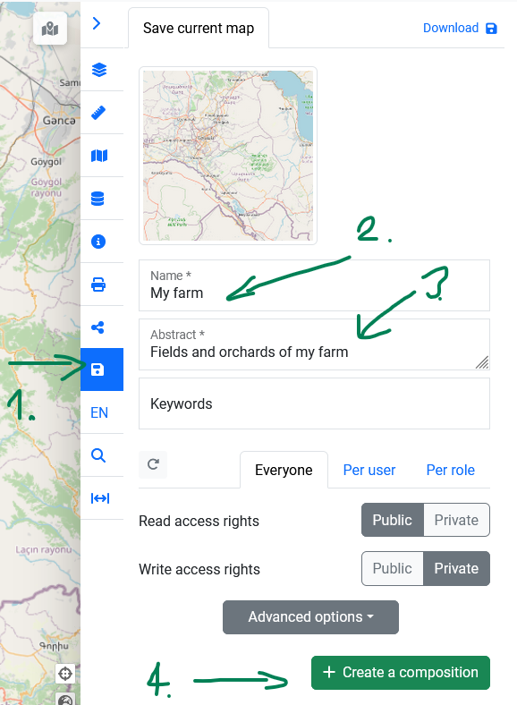
The location of “Save current map” panel and its options in HSLayers-based WebGIS.
The map composition is stored in the compositions catalogue and can be loaded from the “Compositions” panel in the side menu. In this place you can also alter the map composition’s access rights (via the “Set permissions” button), obtain a link for sharing the map composition with your co-workers, or delete the map composition if desired.
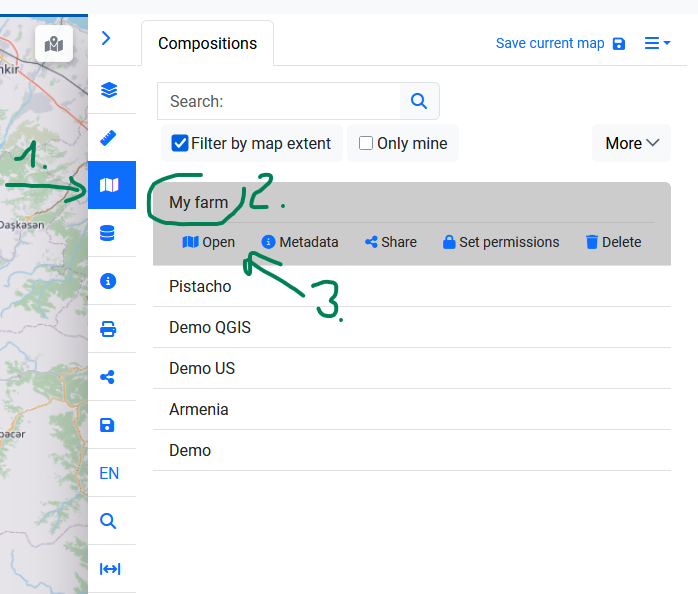
The location of “Compositions” panel and its options in HSLayers-based WebGIS.
Once you make changes to the map composition, i.e. after some layers are added, removed or reordered, you have to go to the “Save current map” panel again, in order to save the changes you made.
Refer to chapters Introduction to GIS, Geodata and Sources of Geodata to learn how to create and add layers in QGIS or WebGIS. Refer to chapter Geodata to see how to vectorise features in QGIS.
Vectorising features in HSLayers-based WebGIS is possible when the “drawing” features are activated. These can be located in two different places in the user interface. Either in the “Draw” panel in the side menu or in the “Draw” toolbar in the upper left corner.
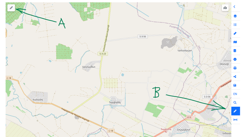
The location of the Draw toolbar (A) and Draw panel (B) in HSLayers-based WebGIS.
The process of drawing new features is the same in both panel and toolbar. Yet while toolbar drawing is only limited to creating new features and their basic editing, the drawing panel can perform more complex editing operations like intersection or union of features.
In order to start drawing features, first select a layer in which the features will belong. If no vector layer is available for drawing, you need to create a new layer first. Once a drawing layer is selected, you have an option to draw following types of features:
- points
- lines,
- polygons,
- circles (which are also polygons, but are drawn in a different fashion).
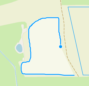
The vectorisation is performed by clicking into the map in the locations of desired vertices, just like when vectorising features in QGIS. When drawing circles, these can be drawn by just two clicks, which define the circle’s centre and its diameter. A drawing sketch is finished by double-click.
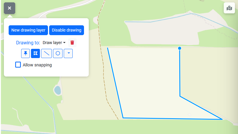
Vectorising a field as a polygon using the “Draw” toolbar.
It is also possible to draw the features with a “free hand” when the SHIFT key is pressed on the keyboard. In that case, the line or polygon vertices are created uniformly while moving the mouse over the map.
A “free hand” sketch.
When the drawing is disabled with the “Disable drawing” button, it is possible to select the features which were already drawn, edit their vertices, edit, add or delete their attributes and also delete the selected features if needed.